11 Days Rwenzori Mountains Hiking Safari
Description
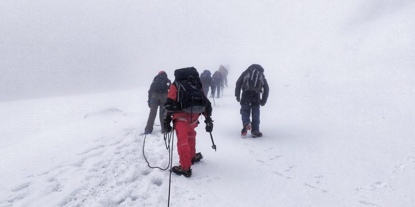
11 Days Rwenzori Mountains Hiking Safari, Rwenzori is located in the western part of Uganda and its an international hiking and mountaineering destination. Among its six snow-capped ranges it has the third highest peak in Africa, the Margherita, situated 5,109m above sea level on the western arm of the Rift Valley. This is one of Africa’s challenges but Never the less it is exciting! If you are interested in hiking, please come try it.
DAY 1: Arrival
Arrive at Entebbe airport you will be met our guide who will then transfer you to your Hotel in Kampala for dinner and overnight. Lindsay Cottages or Cassia Lodge.
DAY 2: Kasese
After breakfast, start your journey to Kasese via Fort Portal town descending the plains overlooking Queen Elizabeth National Park. Arrive in Kasese in the evening and retire to your hotel for dinner and overnight stay at Magherita
Day 3: Start the Great Hike in Uganda
We start early and drive to Rwenzori Mountains National Park and the Rwenzori Mountaineering Services (RMS) offices at Nyakalengija in the morning so as to have ample time to rent equipment and be availed with guides, cooks and porters. Hiking begins from the park headquarters 5,400ft (1,646m) walking past typical “mud and wattle” Bakonzo homes and gradually moving upward through elephant grass and garden plots. It takes approximately 40minutes to reach the park boundary. The trail then follows the Mubuku River and involves climbing over rocks and a bluff, before reaching the Mahoma River in about two and half-hours. After crossing the river there will be a steep climb through open bracken fern slopes and Podorcarpus Forest up to Nyabitaba Hut 8,700ft (2652m).
The total time for an average hiker from Nyakalengija to Nyabitaba is about 5 hours and total elevation gained is 4,000ft (1,200m).
During this part of the trip, you may be able to hear chimpanzees and sometimes you may have a glimpse of the black and white colobus and lots of the Albertine Rift Endemic birds.
Day 4: Rwenzori Mountains
From Nyabitaba Hut the trail leads West ward for half a kilometer then drops steeply to Kurt Shaffer Bridge, crossing below the confluence of the Bujuku and the Mubuku rivers. By turning right to the bridge you begin to climb the central circuit anti-clockwise since the clockwise direction is much more difficult. After the Kurt Shaffer Bridge, the muddy slippery trail climbs steadily up through bamboo forest. After one and a half-hours you encounter an area of slippery boulder hopping.
After 5hrs of traveling from Nyabitaba you reach the hut at Nyamuleju and its accompanying rock shelter which may be a good night stop over. This point also marks the start of giant lobelia and groundsel zone. This remarkable vegetation type is found no where in the world except high-altitude tropical mountains. The 1hour walk to John Matte Hut (11,200ft/3,414m) is through a challenging bog, full of extra ordinary plants and the slow pace can be a delightful chance to examine and photograph this unique environment. Typical time to reach John Matte is about 7 hours.
The loss of altitude to Kurt Shafer Bridge means the total elevation to be gained on this day is about 3,000ft (915m). Hikers who feel they have reached their limits by this point should consider John Matte as a reasonable stopping point.
Day 5: Rwenzori Mountains
Leave John Matte to cross the Bujuku River and enter the lower Bigo bog, where your first experience of jumping from tussock to tussock on a grassy bog begins. The trail is muddy and follows the left (southern) edge of lower Bibo bog until eventually it reaches Bigo Hut and its rock shelter.
A steep section past the hut leads to upper Bigo bog. In the last half of this bog, a boardwalk has been constructed though some may think it is an ugly intrusion, it makes walking easier and prevents the hikers from further damaging the bog. There is a beautiful narrow stream at the upper end of this bog that can make a lovely stop over for lunch.
An hour and a half beyond the upper bog, and after climbing through drier ground and criss-crossing the river, you reach Lake Bujuku. The Southern end of the lake is in a majestic setting with Mount Baker to the south, Mount Stanley to the West and Mount Speke to the North.
The trail route along the lake’s northeastern shore crosses the worst mud on the trip. Beyond the north end of the lake is a rock shelter called cooking pot and a short distance further is Bujuku Hut 13,000ft (3962 m), favorably located for parties climbing Mount Speke which requires technical skills and special equipment. However the shaded location and frequent mists can make Bujuku Hut quiet cold. Time to reach Bujuku from John Matte is typically 3-5 hours and the elevation gained is 1,800ft(560m) but the long stretches of bog and the mud along the lake make this another challenging day.
Day 6: Rwenzori Mountains
From Bujuku Hut leave directly to a newer trail which rises and falls twice before finally climbing steeply through magical moss draped Groundsel vegetation 14,345ft (4,372m) to Scott Elliot pass. At the steepest section is a short h2 ladder after which a right hand branch will lead to Elena Hut 14,700ft (4,430m). This is a steep, rocky trail which when wet can be slippery but continuing straight and a few steps below the pass there is a sheltered spot good for a break. Elena is the base camp for climbing 16,763ft (5,109m) to Margherita Peak in the Mount Stanley complex which requires an additional day or two and can only be attempted with an ice axe, mountain boots, crampons, ropes and prior arrangements with Rwenzori Mountaineering Service guides.
The circuit trail continues to the left over Scot Elliot pass and enters an alpine zone of sparse low vegetation and stark rough boulders more familiar to high altitude climbers from northern altitudes.
As you leave the pass, you may enjoy the spectacular view north of Margherita peak, Elena and Savoia Glaciers, and Mount Baker 15,889ft (4,843m) towering above you to the east or left of the trail.
Having dropped a few hundred feet elevation from the pass, you cut below massive rock walls at the base of Mount Baker, here dramatic “impact craters” have been caused by large rocks falling from above and your guide may caution you against loud noises. Rising and falling, the trail descends past Upper Lake Kitandara, then Lower Lake Kitandara and Kitandara Hut 13,200ft (4,023m). This lovely site is surrounded by towering peaks but the sun sets early and the nights can be cold.
Day 7: Rwenzori Mountains
An early start is advisable to avoid over heating on the steep but lovely hour-long climb from the Lake Kitandara which is 14,050ft (4,282m) to the Fresh field pass. Viewing westward on clear days leads into neighboring Democratic Republic of Congo (DRC) and north, Margherita, and its glaciers still dominate the horizon. Fresh field is a long traverse through beautiful high alpine mossy glades and more mud until after half an hour, when the trail begins the circuit’s long two-day descent. Mist or rain can make tracing the trail difficult, and the first one-kilometer here can be very slippery. Rock shelters at Bujongolo and Kabamba are optional overnight stop over but it is best to push on through the seemingly endless mud to newly constructed Guy Yeoman Hut 10,700ft (3,261m). Some hikers make the Kitandara-Guy Yeoman trip in 5 hours but any stops to enjoy the pass, bad weather on descent, and the slow conditions in the last two hours of deep mud can make this a much longer day.
Day 8: Rwenzori Mountains
As you approach Kichunchu River the trail parallels and twice crosses the Mubuku River mostly in deep mud until the last few kilometers of good dry trail. This follows the ridge down Nyabitaba, which completes the circuit. Typical hikers make Guy Yeoman to Nyabitaba in 5 hours. Should you decide to continue to Nyakalengija it is another two or three hours depending on the condition of your knees and your desire to reach a comfortable bed and bath. Near Nyabitaba Hut is located the beautiful Lake Mahoma, which can be reached with a short walk of 40 minutes return through the bamboo forest. Late evening walking can be good for watching birds and you may sight the occasional blue tailed monkey and sharp eyes may catch a glimpse of the brilliant green but changeable Rhinoceros chameleon.
Day 9: Rwenzori Mountains
Descend to the park headquarters and it can take 2-3 hours. Return to your Hotel in Kasese for relaxation and a cup of hot coffee.
Day 10: Rwenzori Mountains
Leave for Kampala after breakfast. Have a late lunch in a favourite restaurant serving Ugandan local cuisine


